
Story
Augmented and mixed reality content have swooped in to expand on a variety of healthcare, industrial, and entertainment uses. While the professional use of data-visualization is well explored, there are few applications that focus on large-scale geospatial data viewing, and even less that enable multi-user interactions.
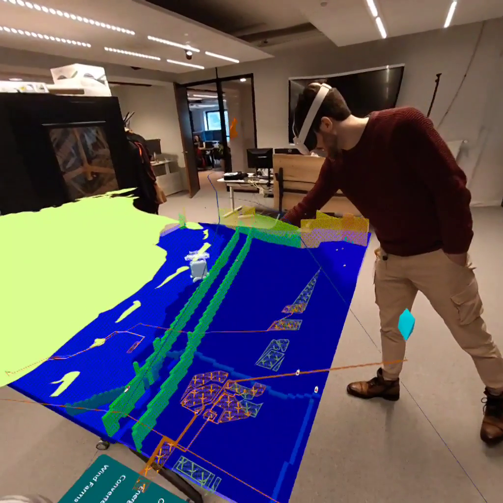
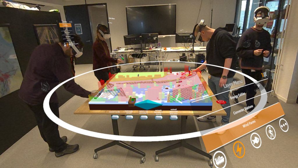
AugGIS is designed to facilitate immersive multi-user stakeholder engagement, providing a mixed reality view over large quantities of geospatial data. This data is projected inside of a shared physical space, to create a digital overlay where a group of users can view, control, and discuss the information provided.
Process
Cradle has been heavily involved in the Marine Planning industry through the development of the MSP Challenge, a platform to host and interact with GeoSpatial data over time and space. Within this project the team organizes sessions to educate students and engage with stakeholders in the marine planning process. We believed that mixed-reality could provide a level of interaction and immersion with the data that we could not achieve behind a regular monitor or paper map.
Explorations of this topic started with a prototype to visualize data from the MSP challenge on a mixed reality headset.
This step defined our use of OpenXR as a backend, and helped us understand the challenges of visualizing large amounts of data on a mobile XR device.
The visualization prototype was used to talk to our stakeholders, and explore how the application could be used.
From these discussions we made a second prototype where we explored new visuals, designed shared interactions, and researched overal user-experience. This prototype was used for our first research paper on Mixed Reality in Marine Spatial Planning, and steered development of the full application.
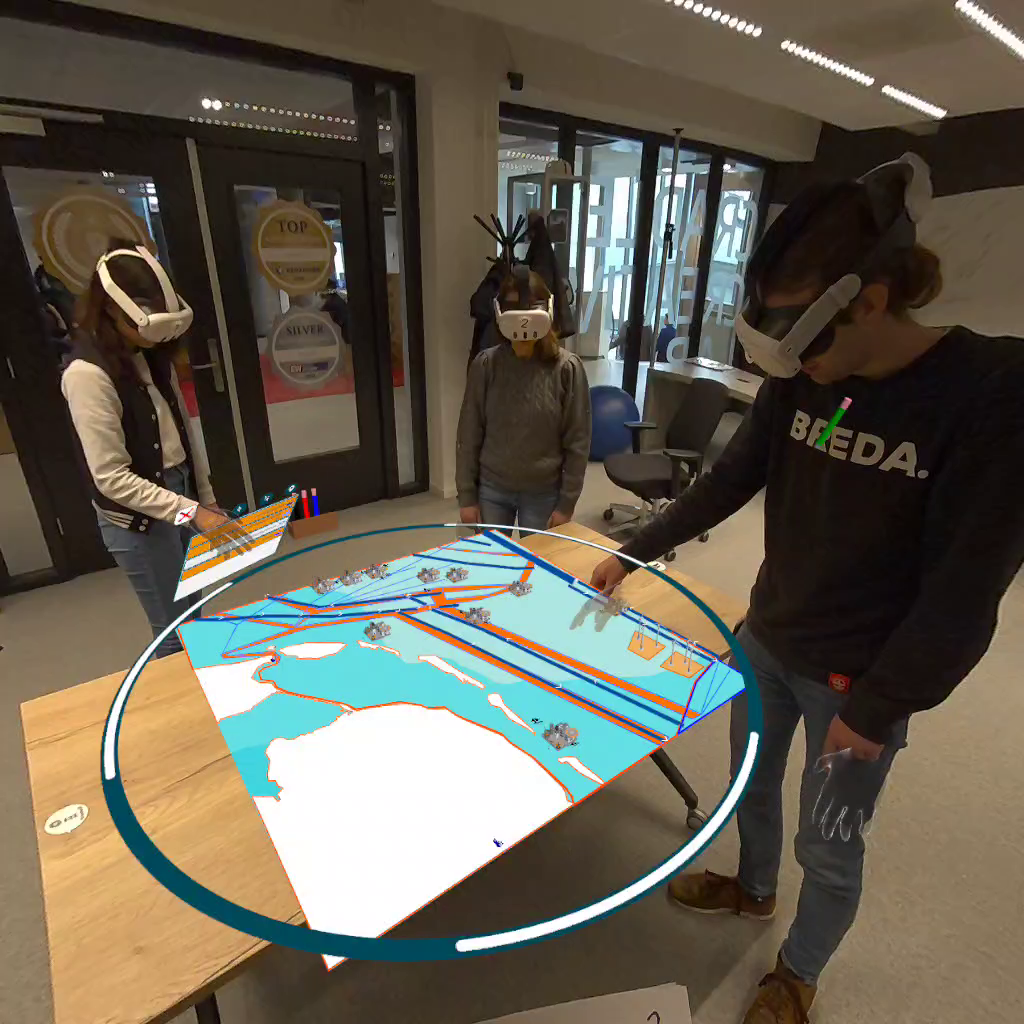
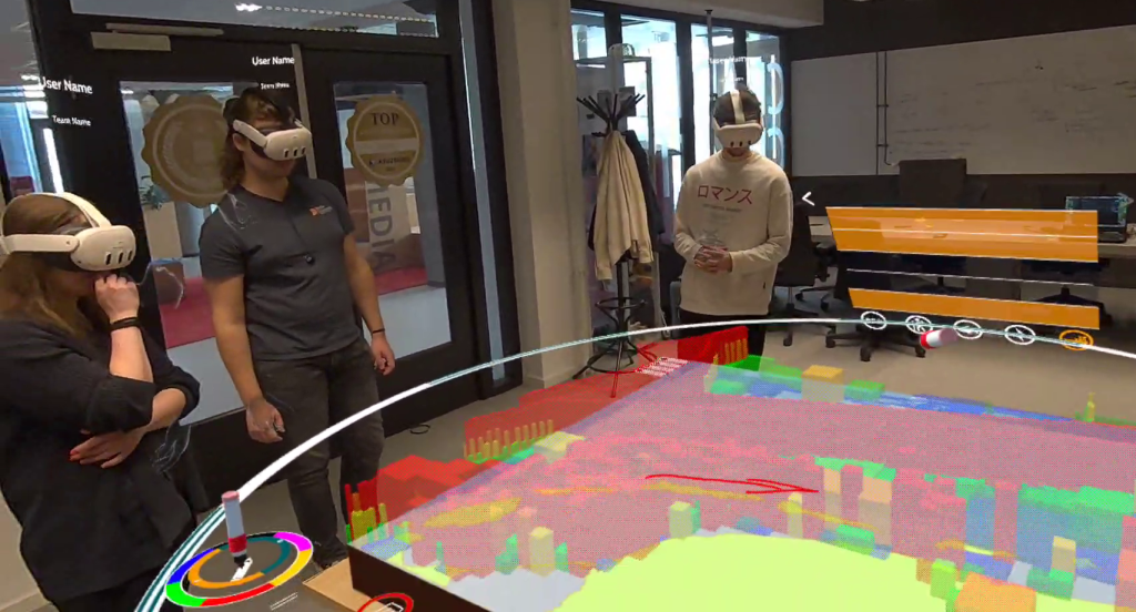
Findings from the two prototypes lead to the full application, build as a platform for stakeholder engagement this application allows the users to place a map within their physical space and physically move around it to view all the available data.
Within the application we focused on MR as a communication tool, this is done through shared interactions which are inspired by physical maps and existing planning behaviour. Layer toggles, pointing with hands, placing little pawns and drawing with a pen are all included in this.
The functional application was initially demoed during a North-Sea partner meeting, where project partners had the opportunity to try the application for a limited time. Two presentations for national and international audiences were then organized to raise interest and gain insight in further industry interest for this application.
While the project is still under active development, we have planned a series of feedback and release sessions to evaluate our tool for both the marine and general planning industries. It is our intention to further optimize this application to create a flexible platform for GIS based stakeholder engagement, both for marine and non-marine use cases.
Results
The current result for AugGIS can be viewed at the top of the page. For a more detailed look at the individual features you can see the video below and the accompanying list of features in the description of the video.
More information on the features will be available once our V1 release has been published.
Technical Details
Client Hardware
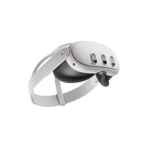
We chose the Meta Quest 3 as our primary development platform due to the price, availability, and support for OpenXR.
We plan to support other OpenXR platforms in the future.

MSP Servers
AugGIS relies on a server application to host a session and distribute the data to the MR headsets. The main release has been closely integrated with the MSP Challenge project for a smooth experience in the sessions we organize, allowing us to boot new servers from the MSP Challenge client.
Local Sessions
The latest version includes a local session option, where GIS data can be loaded using our middleman software. A basic interface is provided to select and configure GIS data, which can then be loaded into a server ran on a windows machine. The client applications (on the Quest 3) can then find and connect to the session on the same local network.
Passthrough
The application uses passthrough features to show both the physical world and the digital components. This passthrough element provides two unique advantages:
- Spatial persistance anchors the users in the existing space, largely eliminating nausea and removing the need for lifelike representations of the other users.
- Interactions and tools work the way they do in real life. Moving is by walking, object interaction is with a hand, and physical and social boundaries are the same as without a headset.
Research Output
AugGIS strives for innovation on several levels, Data Visualization, Mixed Reality, and Collaborative Planning. We therefore aim to research these elements to identify how MR can expand upon the field of GIS data.
XRM 2025 – Qualitative Paper & Book Chapter
The first output of AugGIS is a qualitative conference paper where we explored the overall usability and view on MR as a planning tool using an early prototype of the AugGIS system. The findings of this study indicate that Mixed Reality is ready to successfully merge enjoyment with functional exploration of GIS data, fostering engagement in a playful environment reminiscent of traditional physical interactions. Participants unanimously reported a level of enjoyment, driven by the exploratory nature of the application and technology, which encourages collaborative communication through hand gestures and oral interactions. While the digital interface offers unique advantages over physical maps, such as real-time data visualization and interactive elements, challenges remain in the form of technical limitations and gesture recognition issues that can hinder user experience.
This research has been extended upon in the form of a book-chapter and will be published in the conference proceedings.
Project Funding
AugGIS was developed as part of Norsaic (co-funded by Interreg North Sea Region), which aims to create a future-proof and innovative cooperation governance for next-level transnational Maritime Spatial Planning (MSP) in the North Sea. Norsaic focuses on three key outputs:
1) Adaptation – Planning for the future
Developing visions and strategies for the adaptation and advancement of crucial MSP elements to develop future proof MSP processes and plans in the North Sea region responding to a changing climate.
2) Innovation Capacity for Governance in MSP
Establishing innovation capacity by bringing together competent MSP authorities, regional/ local representatives, as well as research institutions to jointly co-design innovative approaches and tools on multi governance levels for multi-use of space, cumulative impacts of maritime activities and land-sea interaction.
3) Cooperation – Building Joint Capacity
Building joint capacity towards long lasting governance, taking up innovation capacity and crucial MSP visions and strategies towards joint learning and mutual knowledge with competent MSP authorities, regional/ local representatives, as well as research institutions within and beyond the partnership.
More Information
For more information on AugGIS and its connection to the MSP Challenge project, please visit the MSP Challenge website:
Source
You can download the source code for the AugGIS client and server via:
The config tool for local sessions using custom data is public available on the following repo:
